Showing posts with label maps. Show all posts

Tuesday, September 23, 2008

CCK08 Concept Maps


The above map is my attempt to show how information travels in connections beginning with the wiring in the brain; moving to wiring in machines and the Internet; and returning to the brains of course participants.

The more I try to create a concept map around my current understanding of Connectivism, the more I am coming to realize:

1] Thinking in words graphically represented, forces you to see connections you would not otherwise see;

2] Three dimensional models of connectivism would be even richer... but working in 2 dimensions is challenging enough;

3] The more I try to show relationships among ideas, the more I know I don't know so much! This is a challenging task;

4] That concept maps can show relationships more succinctly than words, but the cost in time can be significantly greater on the part of the creator;

5] Ideas with images provide greater insight than do words and arrows among boxes and hexagons;

6] I need to re-prioritize the reading of Dan Roam's Back of the Napkin.

For fun, here is an earlier concept map that I created with Smart Ideas to arrange broad concepts, tools and activities we've been using to explore connectivism. The end result is not nearly as chaotic as I'd originally envisioned.

Saturday, December 22, 2007

Google Holiday Map


The Google Blog has just posted a radical idea for bringing the world together in a compelling way over the next week or so. My Maps are Our Maps invites people to post stories, traditions and more in the form of photographs embedded into a Google Map. (Photos, or YouTube videos can be embedded; but content must be present on the World Wide Web prior to adding it to a Google map.)

The entry includes a link to a Google Map user guide. It will be very interesting to see how this map develops as the personal stories of global celebrations of Christmas, Chanukah and the New Year are added. This is one terrific example of Digital Storytelling!

If only educators had known about this before the end of school for the holiday break...? Certainly there are other classroom and community applications for such a project. It is an engaging idea that can be scaled from classroom, to school, to community, to city, to state/province, to country, to the global community. I'm guessing we'll soon see more than few educational adaptations of this idea... A few of my own ideas are on today's Teacher 2.0 Podcast.

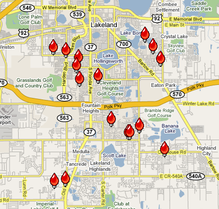
Found one! A local holiday Christmas lights map! This map highlights outstanding light displays in Lakeland Florida, spring home of the Detroit Tigers: